On July 24, 1923, a peace treaty was signed in the Swiss city of Lausanne between the Republic of Turkey and the states that had won the First World War. It was an extremely important agreement in the historical sense, because it defined today’s Turkish borders. The Republic of Turkey renounced the vast territories of the former Ottoman Empire, and committed itself to the free movement of the Bosporus and the Dardanelles. Compared to the previous Sèvres peace agreement, drawn up about three years earlier, the Lausanne agreement was much more favorable to Turkey and it could accept it without shame.
Note that according to the aforementioned previous agreement from Sèvres, Turkey should have been almost dismembered. Namely, it was to be deprived of a large Kurdish territory in the east, a considerable part of the coast of Asia Minor around the city of Izmir, as well as most of its European territory, almost close to Istanbul. Under the agreement, Turkey was to be divided into zones of influence by foreign powers (the United Kingdom, France and Italy). The Sèvres agreement was unacceptable for Turkey in practice, so a stable relationship with the victorious foreign powers was established only with the signing of the aforementioned Lausanne peace agreement. With it, the Republic of Turkey retained the Kurdish territories in the east, İzmir in Asia Minor, and the European hinterland of Istanbul, and was actually located within its present-day state borders.
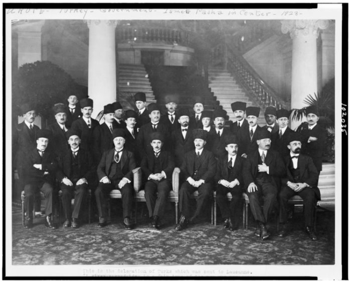
The chief Turkish negotiator in Lausanne was Mustafa İsmet İnönü, who used rather peculiar methods of Turkish favor. Namely, during the speeches of the British Lord Curzon, who led the conference and tried to thwart Turkish stubbornness, Mustafa İsmet İnönü used to turn off his hearing aid, so that later he could continue to advocate Turkish views as if Lord Curzon had said nothing.