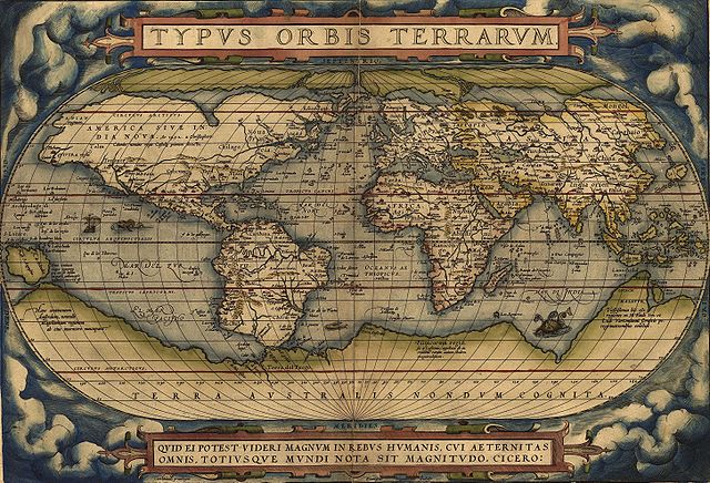
The atlas called Theatrum Orbis Terrarum was made by Flemish cartographer Abraham Ortelius.
The first modern atlas was published on this day in 1570. It was entitled Theatrum Orbis Terrarum and was published in Antwerp. The city is now in Belgium, but at the time the atlas was published it was held by Spain, as part of the so-called Habsburg Netherlands. It was made by the famous Flemish cartographer Abraham Ortelius, who was a native of Antwerp. His surname is sometimes written as Ortels, Orthellius, or Wortels.
Theatrum Orbis Terrarum contained 53 richly decorated and illuminated maps. As many as 25 editions of the atlas were published by the time of Ortelius’s death in 1598, which is a clear indicator of its popularity. It contained maps of the Americas, which were still poorly-explored by the Europeans at that time. Ortelius’s atlas is generally considered to be the pinnacle of 16th-century mapmaking.